
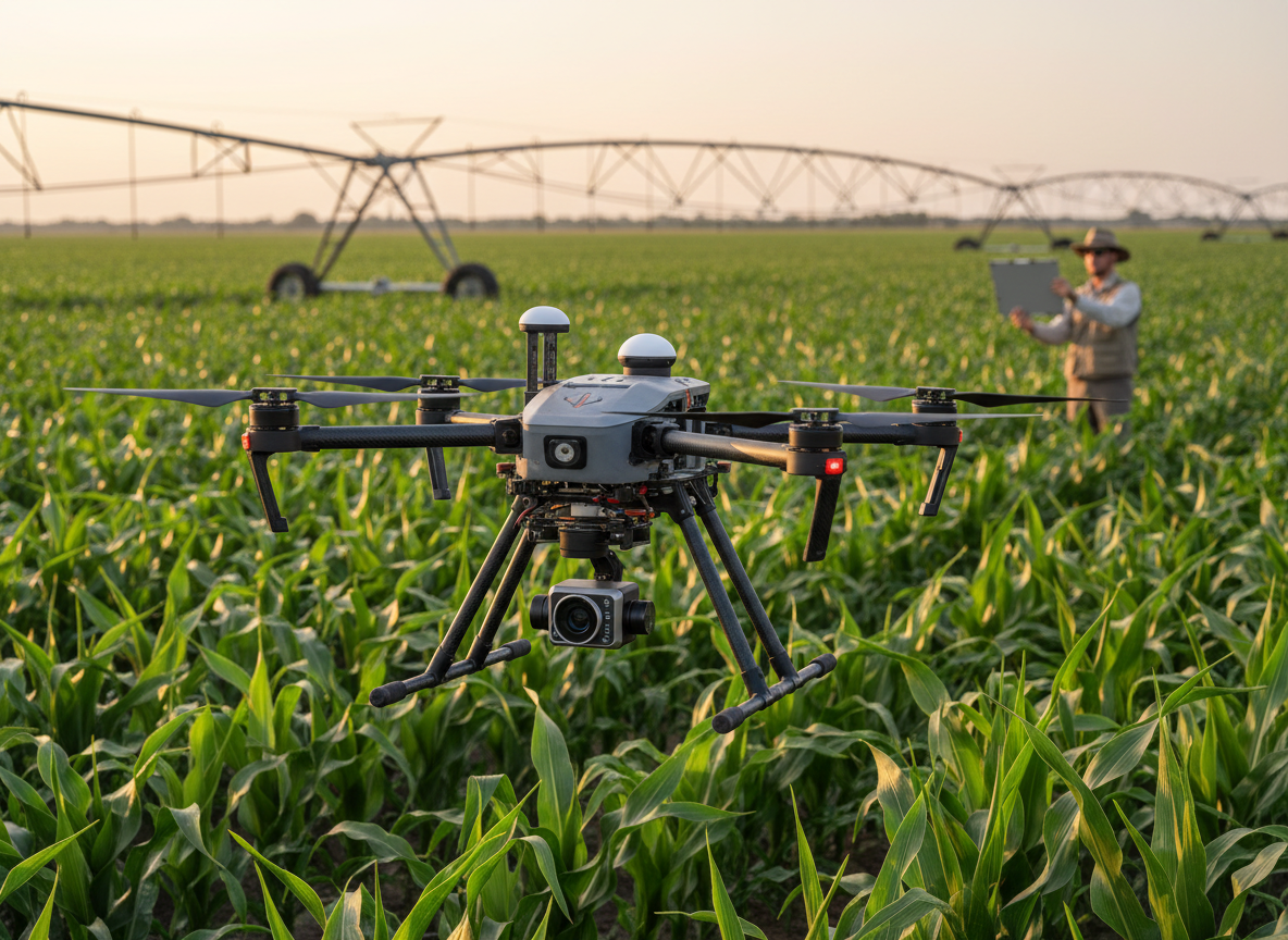
Editorial disclosure: This independently researched buying guide is based on manufacturer documentation, support materials, and current dealer listings. All About UAVs has not hands-on tested the Altum-PT, and no manufacturer or dealer sponsored this article.
The MicaSense Altum-PT is a specialized aerial sensor for teams that need multispectral, panchromatic, and radiometric thermal imagery from the same flight. It is aimed principally at agricultural researchers, crop consultants, irrigation specialists, plant breeders, environmental scientists, and service providers whose decisions depend on calibrated and repeatable data—not pilots looking for an ordinary visual camera.
Our recommendation is conditional. The Altum-PT remains a capable option when synchronized thermal and multispectral data are essential, but EagleNXT now also lists an Altum-PT Pro. A new buyer should not order the original model without first obtaining a written comparison of current U.S. availability, support life, thermal performance, integration requirements, and price for both versions.
What the Altum-PT actually captures
EagleNXT’s current documentation describes a 12.4-megapixel panchromatic imager, five 3.2-megapixel global-shutter multispectral imagers, and a 320×256 radiometric FLIR Boson thermal sensor. The five narrow bands are blue at 475 nm, green at 560 nm, red at 668 nm, red edge at 717 nm, and near-infrared at 842 nm. These are verified published specifications, although All About UAVs has not independently measured their optical or radiometric performance.
The manufacturer advertises pan-sharpened multispectral ground resolution of about 1.25 cm per pixel at 60 meters and thermal ground resolution of roughly 17 cm per pixel at the same altitude. Those are geometric resolution claims, not guarantees that the system will identify a particular disease, irrigation failure, weed, or plant trait. Useful detection depends on flight timing, calibration, crop stage, weather, ground truth, processing, and the quality of the agronomic model.
The included DLS2 measures incident light and sun angle for the five multispectral bands. The kit also includes a calibrated reflectance panel; EagleNXT recommends photographing that panel before and after each flight. These tools help normalize changing illumination and support comparisons over time, but the company does not claim that cloud shadows are simply “eliminated.” Consistent collection practices still matter.
Capabilities—and important limitations
Capturing all three data types together can reduce alignment problems associated with separate missions. It supports outputs such as NDVI, NDRE, color infrared, pan-sharpened multispectral products, and temperature maps. Thermal imagery can reveal canopy or soil temperature differences associated with irrigation patterns and plant stress, while multispectral data can help identify physiological changes that may precede obvious RGB symptoms.
That does not mean the camera calculates Crop Water Stress Index in real time or diagnoses a failed pump by itself. CWSI requires reference temperatures or an appropriate model, environmental context, processing, and interpretation. A hot canopy can indicate reduced evaporative cooling, but temperature differences can have several causes. The sensor collects evidence; a validated workflow turns that evidence into a decision.
The official integration guide lists thermal accuracy of ±5 K and sensitivity below 60 mK. Those measurements describe different properties: sensitivity is the ability to distinguish small relative temperature differences, while absolute accuracy describes how close a reading may be to the true temperature. Buyers who require defensible temperature measurements should verify whether the original Altum-PT meets their tolerance or whether the newer Pro model materially improves the application.
Weight, storage, power, and aircraft integration
The current official integration guide lists 460 grams for the camera plus DLS2—not the 577 grams repeated in some dealer material. The camera measures approximately 110×80×69 mm, accepts 7.0–25.2 VDC, draws about 10 watts continuously and up to 12 watts at peak, and uses CFexpress storage. The manufacturer states a maximum capture rate of two captures per second, depending on configuration and storage performance.
“Open integration” should not be read as universal plug-and-play compatibility. The sensor supports Ethernet, serial/MAVLink, HTTP, GPIO and other triggering approaches, while a SkyPort option is documented for DJI’s Matrice 300 RTK. Each aircraft installation still requires verified mounting, power, trigger, cooling, vibration isolation, field of view, DLS2 placement, weight-and-balance, and landing protection. EagleNXT currently names DJI, DeltaQuad, Quantum Systems, Inspired Flight, and Freefly among compatible drone brands, but buyers should confirm the exact aircraft, mount, firmware, and supported workflow.
Price, availability, and package contents
EagleNXT provides a “Buy Now” path but does not display a universal price on its product page. As of September 2026, dealer listings show $15,495 for the sensor kit, and Advexure lists a DJI SkyPort kit at $17,490 while noting that the manufacturer restricts online pricing and purchase. When we rechecked on September 26, 2026, both DSLRPros and DroneFly marked the Altum-PT sold out. These are third-party market findings, not a manufacturer list price or proof of immediate availability, so request a written quote with a confirmed ship date. The underlying integration kit can also change total cost.
EagleNXT says the standard camera kit includes the Altum-PT, DLS2 with embedded GPS, CRP2 reflectance panel, CFexpress card and reader, Wi-Fi adapter, carrying case, lens cover, mounting hardware, start guide, and integration cables. Buyers should confirm whether a quoted package includes the aircraft-specific mount, gimbal or SkyPort, installation work, training, processing software, calibration services, spares, and support.
Regulatory and procurement considerations
The Altum-PT is a payload rather than a complete aircraft, so U.S. operating requirements attach to the finished drone configuration and mission. Adding the sensor can change takeoff weight, endurance, center of gravity, and operating limitations. Commercial flights generally require the appropriate FAA authority, registration, Remote ID compliance, and airspace authorization where applicable. Producing an agronomic prescription does not itself authorize pesticide application; applicators must separately follow federal, state, label, licensing, and recordkeeping requirements.
EagleNXT calls all MicaSense-series sensors NDAA compliant and says they are designed, engineered, and manufactured in the United States. Public-sector buyers should still verify the exact part number, mount, host aircraft, controller, communications hardware, software, and procurement requirements. A compliant sensor does not make every assembled drone configuration automatically eligible.
Alternatives and the Pro question
The RedEdge-P retains multispectral and panchromatic imaging without thermal, making it a lower-complexity option when temperature data are unnecessary. DJI’s Mavic 3 Multispectral integrates aircraft and camera at a lower system price but lacks a radiometric thermal sensor and offers fewer spectral bands. Sentera systems provide other high-resolution and multispectral combinations, while separate thermal and multispectral payloads may offer more flexibility at the cost of synchronization and additional missions.
Most importantly, EagleNXT now markets both Altum-PT and Altum-PT Pro. EagleNXT’s September 3, 2026 launch announcement says the Pro moves to a FLIR Boson 640R radiometric thermal sensor while keeping the multispectral and panchromatic capabilities, but it does not say whether the original model will stay on sale and does not publish Pro pricing. Our September 8 news coverage discusses the newer sensor; this article instead evaluates ownership of the original Altum-PT. Until EagleNXT confirms the two models’ positioning, the safest editorial inference is that buyers should compare them directly rather than assuming the original is obsolete—or assuming the Pro automatically provides better value.
Questions to answer before purchase
- Is the original Altum-PT still a current U.S. product, and how long will firmware, repairs, and calibration support continue?
- What does the quoted package include for the exact host aircraft?
- What measurement accuracy and processing workflow does the intended application require?
- How does Altum-PT differ materially from Altum-PT Pro?
- Can the vendor provide representative raw data and a demonstration using the buyer’s crop, altitude, and deliverable?
Bottom line
Altum-PT is best understood as a scientific data-collection payload, not an automatic crop-diagnosis system. Its synchronized spectral and thermal capture can be valuable when the organization already has a disciplined calibration, processing, validation, and decision workflow. New buyers should pause long enough to compare the original sensor with Altum-PT Pro and obtain a complete integration-and-support quote before committing.
Read our related update, What the New Altum-PT Pro Drone Sensor Means for Mapping. Primary technical sources include the official Altum-PT product page and MicaSense integration guide.
Leave a Reply