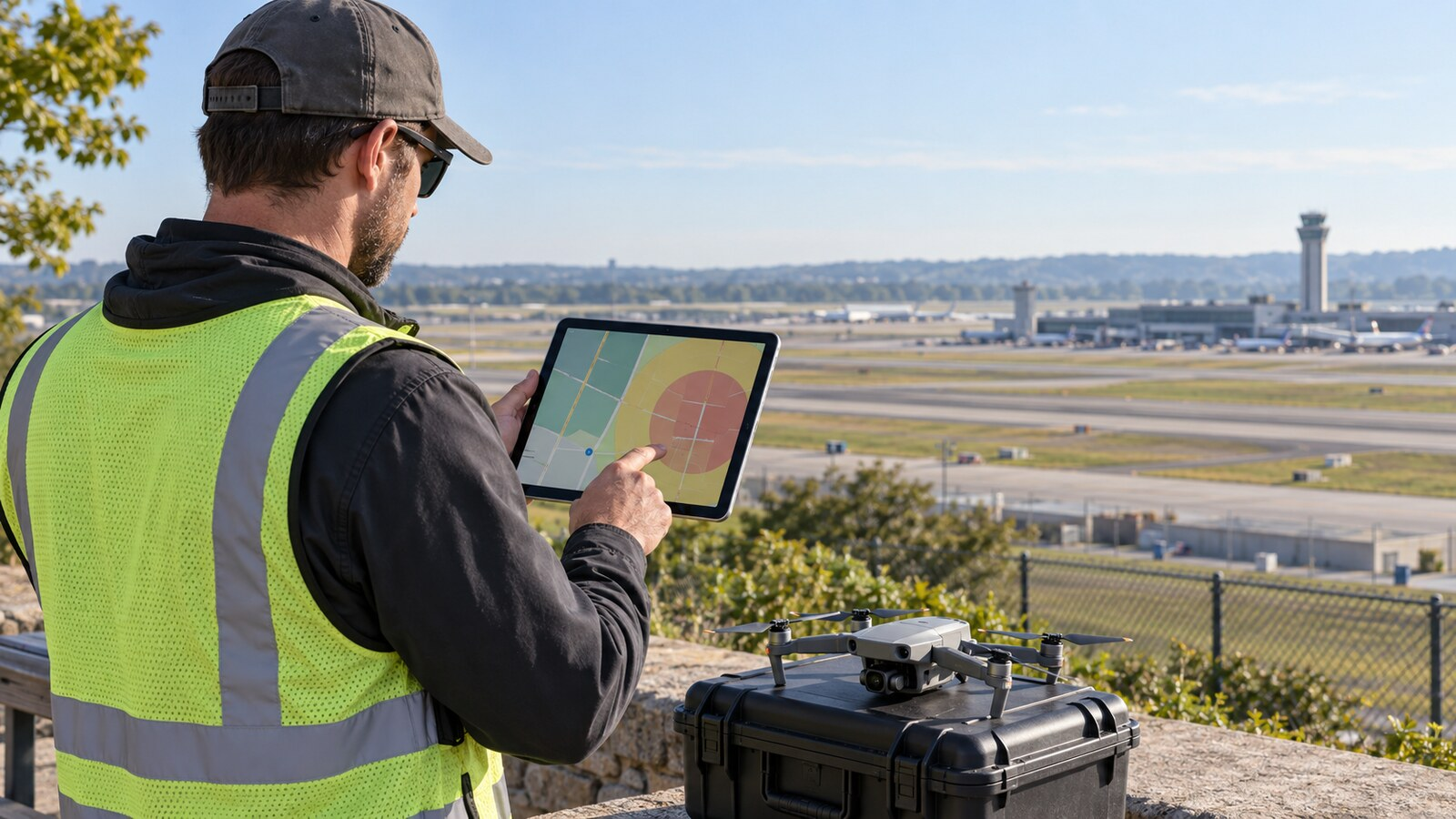
Finding controlled airspace does not automatically kill a commercial drone job. It changes the planning sequence. A Part 107 pilot should identify the exact location and altitude, read the UAS Facility Map as planning information, request authorization through an FAA-approved LAANC provider when available, and then read every authorization condition before flying. Approval can arrive quickly, but it is not a blanket clearance and it does not replace weather, NOTAM, TFR, site, or operational checks.
What LAANC actually does
LAANC stands for Low Altitude Authorization and Notification Capability. The FAA operates it through approved private UAS Service Suppliers, whose mobile and desktop applications submit pilot requests and return authorization information.
Under 14 CFR §107.41, a remote pilot may not operate in Class B, C, or D airspace, or within the lateral boundaries of the surface area of Class E airspace designated for an airport, without prior air traffic control authorization. LAANC is one way eligible Part 107 pilots obtain that authorization for operations at or below 400 feet.
The FAA says LAANC checks requests against data that include airspace classes, airports, UAS Facility Maps, Temporary Flight Restrictions, NOTAMs, and Special Use Airspace schedules. If the request fits the available parameters, approval may arrive in near-real time. That speed is useful, but the authorization remains limited to the submitted location, altitude, date, time, and conditions.
Step 1: Locate the job before requesting anything
Start with the actual operating area, not simply the client’s mailing address. Mark the launch point, expected flight footprint, highest required altitude above ground level, nearby obstacles, and any area where the aircraft may need to maneuver.
Then determine which airspace applies at the surface and at your planned altitude. Our beginner’s sectional-chart guide explains how to read airspace boundaries and floors. Remember that a sectional chart is an important planning source, but it does not itself grant authorization or provide every current restriction.
If the site is in uncontrolled Class G airspace and no other restriction applies, §107.41 does not require controlled-airspace authorization. If the operation is in the controlled airspace described by the rule, continue to LAANC or the manual FAA process.
Step 2: Read the UAS Facility Map correctly
UAS Facility Maps divide areas around airports into grids with altitude values. The FAA describes those values as the maximum altitudes where it may authorize Part 107 operations without additional safety analysis.
The number is not permission to fly. The FAA explicitly says UAS Facility Maps are informational only. A grid marked “100,” for example, may support an authorization request up to 100 feet AGL under the applicable process; it does not mean any pilot can launch there automatically.
A zero-foot grid also does not necessarily mean that authorization is impossible. It means near-real-time approval at a positive altitude is not available under that grid value. A certificated Part 107 pilot may submit a further-coordination request for an operation up to 400 feet, but air traffic review is required and approval is not guaranteed.
Step 3: Choose the correct request path
Use an FAA-approved LAANC service supplier when the airport and requested operation are supported. The FAA lists current public providers rather than endorsing a single commercial app.
There are three common paths:
- Near-real-time LAANC request: for a precise operation at or below the applicable Facility Map altitude.
- LAANC further coordination: for a Part 107 request above the grid value, including a positive-altitude request in a zero-foot grid, while remaining at or below 400 feet.
- FAA DroneZone authorization: for controlled airspace near airports that do not offer LAANC, or for requests handled through the manual process.
Timing matters. The FAA’s August 25, 2026 LAANC guidance says further-coordination requests may be submitted up to 90 days in advance. Its separate Part 107 authorization page advises at least 72 hours for LAANC further coordination and at least 60 days for manual authorization requests. Treat those as planning minimums, not promises of approval.
Step 4: Request only the airspace you need
A strong request is specific. Enter the smallest practical operating area, the lowest altitude that accomplishes the job, and a realistic time window. Broad footprints, unnecessary altitude, or an all-day window can make the operation harder to evaluate and may create conditions you do not need.
For a roof inspection, the client may want “400 feet” because that number is familiar. If the structure and capture plan require only 120 feet AGL, request 120 feet. For a construction site, draw the operating area around the project rather than the entire neighborhood.
Before submitting, verify the date, local time, location, altitude, pilot identity, and operating rule. A typo in the pin location or time window can leave the authorization useless at the jobsite.
Step 5: Read the authorization, not just the approval banner
Save the authorization and read its full text. Confirm the approved lateral area, maximum altitude AGL, start and end times, and any operating provisions. Make the authorization available to the remote pilot in command and crew during the operation.
Do not assume you must call the airport tower. The FAA says pilots generally do not need to notify the tower unless the authorization specifically requires it. Unrequested calls can add confusion because LAANC already provides air traffic personnel visibility into approved operations.
If any part of the mission falls outside the approved location, altitude, or time, revise the plan or obtain the appropriate authorization. Client delay, battery trouble, or changing light does not silently extend an expired window.
What LAANC approval does not authorize
LAANC addresses controlled airspace authorization. It does not waive unrelated Part 107 requirements or other restrictions. After approval, the remote pilot still needs to verify:
- Current TFRs, NOTAMs, weather, visibility, and Special Use Airspace status
- Visual-line-of-sight and crew-communication requirements
- Operations over people and moving vehicles
- Night-operation training and anti-collision lighting requirements
- Remote ID, registration, and aircraft condition
- Property access and local takeoff-or-landing restrictions
- Site hazards, emergency activity, and a safe operating area
Our guide to Part 107 night flying explains why controlled-airspace approval and night-operation compliance are separate questions. The remote pilot in command remains responsible for the overall safety and legality of the flight.
Common LAANC mistakes
Treating a Facility Map number as automatic permission
The grid value helps the FAA evaluate a request. An actual authorization is still required in controlled airspace.
Requesting 400 feet by default
Ask for the altitude the deliverable requires. A lower, precise request may fit the grid and simplify the approval.
Waiting until arriving onsite
Near-real-time approval is not universal. The site may require further coordination or a manual DroneZone request.
Assuming approval covers every rule
Airspace authorization does not legalize flight over people, beyond visual line of sight, during a TFR, or outside other Part 107 limits.
A practical go/no-go sequence
- Pin the actual operating area and required altitude.
- Identify the airspace at the surface and planned height.
- Check the Facility Map grid as planning information.
- Select near-real-time LAANC, further coordination, or DroneZone.
- Submit a precise location, altitude, date, and time.
- Read and retain the full authorization.
- Recheck TFRs, NOTAMs, weather, restrictions, and site conditions.
- Brief the crew on the authorization boundary and stop-work conditions.
- Fly only within the approved envelope and applicable regulations.
The bottom line
LAANC is most useful when it becomes part of ordinary job planning rather than a last-minute button. Start with the client’s deliverable, request only the location and altitude you need, allow time for coordination, and treat the authorization as one layer of the final go/no-go decision. That approach protects the schedule, reduces preventable denials, and keeps a promising job from turning into an avoidable airspace violation.
Reviewed September 6, 2026. This article provides general educational information, not legal advice. FAA systems, providers, procedures, and authorization conditions can change; verify current requirements before each operation.