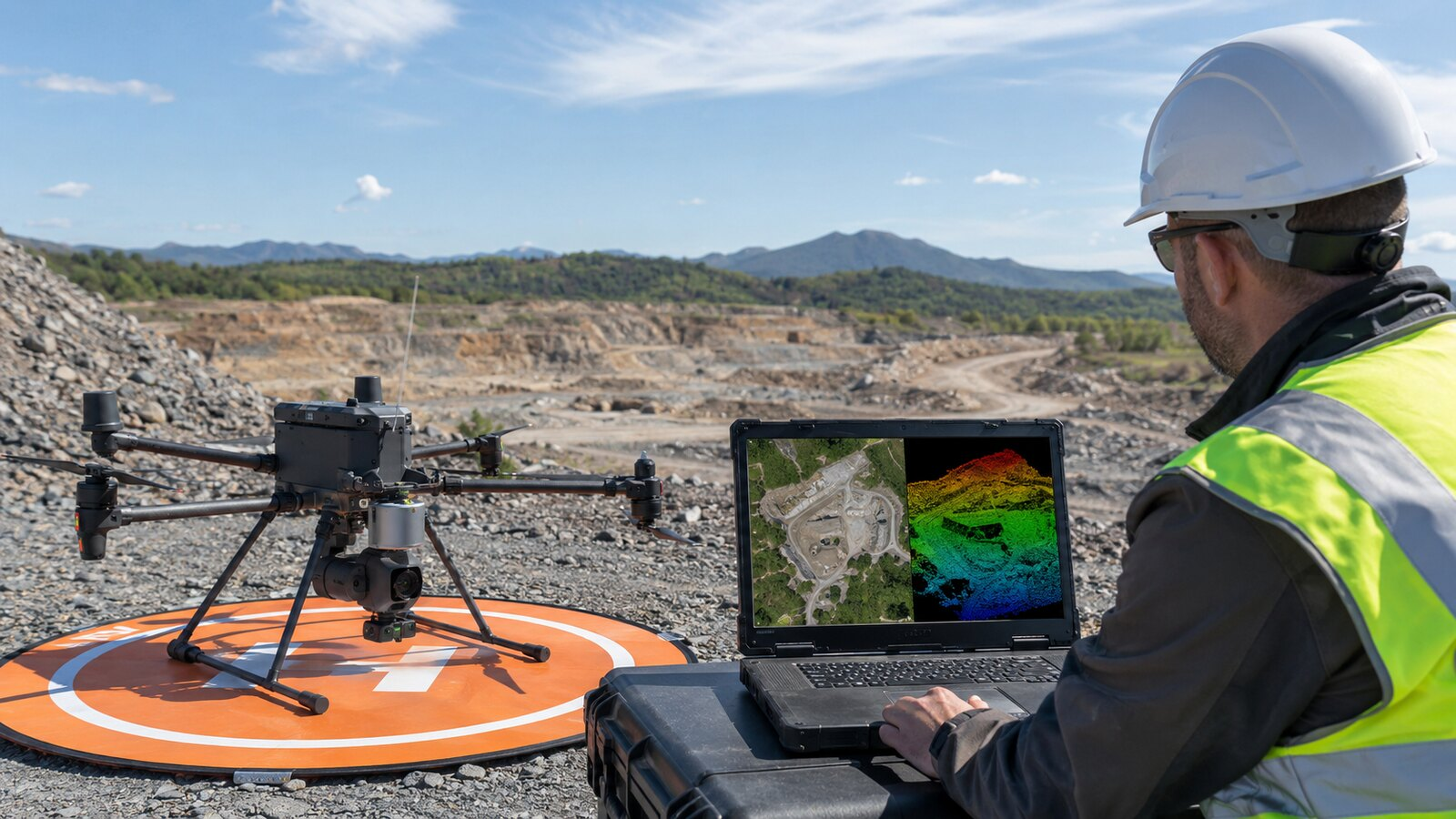
The practical choice between LiDAR and photogrammetry starts with the client’s deliverable—not the sensor. Photogrammetry is often the efficient choice for color-rich maps and models of open, well-lit sites. LiDAR can justify its higher system and processing cost when the job depends on terrain beneath vegetation, complex vertical geometry, or surfaces that are difficult to reconstruct from photographs. In either workflow, accuracy must be designed, checked, and reported.
What each mapping workflow actually measures
Photogrammetry reconstructs three-dimensional geometry from overlapping photographs. Processing software matches features across images and can produce an orthomosaic, point cloud, digital surface model, textured mesh, contours, and measurements. Because the camera also records visible color and texture, photogrammetry is especially useful when the client needs an intuitive visual record.
LiDAR is an active ranging system. It emits laser pulses and combines the measured returns with the aircraft’s position and orientation to create a point cloud. Modern systems can record multiple returns from a pulse. That does not mean a laser simply “sees through” solid vegetation; it means some pulses may pass through gaps in foliage and return from lower branches or the ground. The USGS LiDAR Base Specification requires multiple discrete returns for conventional lidar collections and sets detailed collection and quality requirements.
Where photogrammetry is usually the better fit
Photogrammetry is a strong default for construction progress, stockpile volumes, roofs, façades, quarries, open earthwork, and other scenes with visible texture. It can deliver both measurable geometry and natural-color imagery that a client can understand without specialized point-cloud software.
The limitations matter. Water, glass, moving vegetation, deep shadows, repetitive surfaces, and blank roofs or pavement can reduce reliable feature matching. Light, overlap, exposure, flight altitude, lens calibration, and ground sampling distance all affect the result. A clean-looking orthomosaic is not proof that its coordinates or elevations meet the project requirement.
Where LiDAR can earn its higher cost
LiDAR is often the better candidate when the required product is a bare-earth terrain model under partial vegetation, a detailed corridor or utility model, or a point cloud of complex structures. Multiple returns and point classification can help separate vegetation from ground when enough laser energy reaches the surface.
LiDAR also has constraints. Water and highly reflective or absorptive surfaces can produce weak or missing returns. The system’s range, beam divergence, scan pattern, return settings, point density, GNSS/IMU solution, calibration, and classification workflow all influence the final data. More points do not automatically mean a more accurate deliverable.
Accuracy depends on the whole workflow
“Centimeter-level” is not a universal promise for either method. Project accuracy depends on the sensor, flight height and speed, positioning solution, calibration, control network, processing settings, surface type, and how the result is tested. RTK or PPK can improve camera or trajectory positions and may reduce the amount of ground control needed, but it does not eliminate independent checkpoints or quality assurance.
The 2024 ASPRS Positional Accuracy Standards include separate best-practice addenda for lidar, photogrammetry, and UAS mapping. Among the changes, ASPRS increased the minimum number of checkpoints used for product accuracy assessment and requires checkpoint accuracy to be considered when computing final product accuracy. That is a useful reminder: report what you tested, not what a payload brochure suggests.
| Project need | Photogrammetry advantage | LiDAR advantage | What to verify |
|---|---|---|---|
| Color orthomosaic or visual progress record | Native RGB detail and texture | May add color, but is rarely the reason to choose it | GSD, exposure, overlap, checkpoints |
| Bare-earth terrain under foliage | Limited where the camera cannot see the ground | Multiple returns may capture ground through canopy gaps | Ground-return density and classification quality |
| Stockpiles and open earthwork | Often efficient on well-textured surfaces | Useful when geometry or lighting challenges image matching | Surface completeness and volume check method |
| Corridors or complex vertical assets | Good when coverage and texture are sufficient | Direct ranging can capture detailed geometry | Scan angles, shadows, trajectory quality |
| Survey-grade claim | Neither method qualifies by label alone | Scope, datum, control, checkpoints, standard, signed deliverable | |
Price the required deliverable, not a generic acre
There is no defensible universal per-acre price for either workflow. Two sites of the same size can require very different flight planning, access, control, processing, classification, cleanup, travel, insurance, and reporting. LiDAR hardware and software usually raise the operator’s fixed cost, but the method can save time or reduce uncertainty on the jobs it suits. Photogrammetry may be less expensive to acquire, yet complex imagery or manual cleanup can erase part of that advantage.
Build the quote from the area and terrain, required outputs, accuracy class, control and checkpoint plan, point density or image GSD, airspace and access, processing effort, file hosting, revisions, reflight risk, and whether a licensed surveyor must supervise or certify the work. Our guides to commercial drone job pricing and starting a drone inspection business explain how those costs fit into a sustainable service.
Treat payload specifications as test conditions
Manufacturer specifications are useful for narrowing a shortlist, but they are not guarantees for every field job. For example, DJI describes the Zenmuse P1 as a 45-megapixel full-frame mapping camera and publishes conditional horizontal and vertical accuracy figures tied to stated flight speed, overlap, and ground sampling distance. DJI’s Zenmuse L2 specifications list up to five returns and publish system-accuracy figures measured under specific laboratory and flight conditions with RTK fixed, exposed checkpoints, calibration, and DJI Terra processing.
Those examples are not endorsements and they are not the only systems available. Compare the complete stack: aircraft, payload, GNSS base or correction service, control equipment, processing software, computer and storage requirements, calibration procedures, training, support, export formats, and client compatibility. If you are still choosing an aircraft, start with the deliverables in our inspection-drone buying guide.
A practical selection sequence
- Write down the exact client deliverables and coordinate system.
- Inspect the surface, vegetation, lighting, access, and likely data gaps.
- Define the required accuracy standard and independent checkpoint plan.
- Confirm whether the work crosses into regulated land surveying in the project jurisdiction.
- Estimate acquisition, processing, classification, cleanup, reporting, and reflight costs for both methods.
- Run a small pilot area and compare completeness and checkpoint results before committing to a large collection.
The best workflow is the least complicated one that can reliably produce the contracted result. Before buying a sensor or quoting the job, ask the client for a sample deliverable, an accuracy requirement, and the decision the data must support. Those three answers will usually make the LiDAR-versus-photogrammetry choice much clearer.